When I first embarked on my journey into the world of architectural documentation, the blueprints were my trusted compass. They were elegant, precise, and seemed to hold all the answers to the physical form of a building. Yet, as I delved deeper, I began to feel like a cartographer trying to map uncharted waters with only a sextant and a star chart. There were nuances, subtleties, and hidden dimensions that the traditional lines on paper struggled to fully convey. This realization led me to the fascinating comparative exploration of blueprints versus the more modern, technologically advanced method of Lidar mapping.
For centuries, the blueprint has been the bedrock of architectural design and construction. Its simplicity belies its profound impact. Imagine a meticulously crafted tapestry, woven with threads of precise measurements and intentions, each line a testament to human planning and an envisioned reality. That’s what a blueprint represents to me.
The Genesis of Architectural Representation
The very concept of translating three-dimensional space onto a two-dimensional plane is an art form in itself. It requires an understanding of perspective, scale, and symbolic representation. I’ve spent countless hours poring over these documents, tracing the phantom outlines of walls, understanding the flow of spaces, and deciphering the language of architectural intent.
The Precision and Limitations of Two-Dimensionality
A blueprint, at its core, is a projection. It’s a carefully curated slice of reality, offering a view from specific angles. This inherent two-dimensionality, while allowing for clear communication of dimensions and spatial relationships on a flat surface, can sometimes obscure the depth and complexity of a structure. It’s akin to looking at a still photograph of a bustling city; you see the buildings and the streets, but you miss the dynamic movement, the cacophony of sounds, and the sheer multi-layered existence happening all around.
The Human Element in Interpretation
Interpreting blueprints requires a skilled eye and a degree of creative imagination. I’ve learned that a single line can represent a load-bearing wall, a simple partition, or even the edge of a ceiling. The context, coupled with the accompanying notes and annotations, is crucial. This reliance on human interpretation, while fostering a deeper engagement with the design, also introduces a potential for subjective bias or misinterpretation.
In exploring the fascinating intersection of hidden room blueprints and LIDAR mapping technology, one can gain deeper insights into how these methods complement each other in uncovering concealed spaces within structures. For a more detailed discussion on this topic, you can refer to the article available at this link, which delves into the advantages and limitations of each approach, providing a comprehensive overview for enthusiasts and professionals alike.
The Dawn of Lidar: Painting with Light
Then came Lidar. When I first encountered its capabilities, it felt like stepping out of a dimly lit room into a brilliantly illuminated space, where every nook and cranny was suddenly visible. Lidar, which stands for Light Detection and Ranging, is a remote sensing method that uses laser light to measure distances to the Earth or other objects. In the context of architecture, it’s a game-changer.
The Science Behind the Scan
At its heart, Lidar works by emitting pulsed laser beams and measuring the time it takes for the reflected light to return to the sensor. This time-of-flight measurement, when combined with the speed of light, gives an incredibly precise distance. Imagine firing a million tiny, invisible arrows at a building and precisely measuring how long each one takes to bounce back. This creates a dense cloud of data points, each representing a specific location in space with remarkable accuracy.
The Creation of the Point Cloud: A Digital Replica
The output of a Lidar scan is a “point cloud.” This is not a drawing or a representation, but a near-literal digital copy of the scanned environment. Each point in this cloud carries X, Y, and Z coordinates, effectively creating a three-dimensional model of the scanned object or area. For me, working with a point cloud is like holding a ghost of the building in my hands, a tangible, albeit digital, representation that captures its form with an unprecedented level of detail.
The Accuracy and Detail of Lidar Data
The accuracy of Lidar scans can be astonishingly high, often down to millimeters. This level of precision is invaluable when dealing with complex structures, historical buildings where subtle deformations might be significant, or even in situations where exact measurements are critical for restoration or integration of new elements. It removes much of the guesswork and reliance on assumed straight lines or perfect angles that can sometimes plague blueprint interpretation.
Bridging the Gap: Blueprints as the Foundation, Lidar as the Enhancement
It’s crucial to understand that Lidar mapping doesn’t necessarily replace blueprints entirely; rather, it complements and enhances them. The blueprint still holds its value as a conceptual document, the initial design intent. Lidar, in this context, becomes the highly detailed, empirical verification.
The Blueprint as the Intent
The blueprint is the architect’s vision, the codified dream. It dictates the intended relationships between spaces, the flow of movement, and the structural logic. It’s the abstract thinking made manifest. When I look at a blueprint, I’m seeing the idea of the building, the intentional design choices.
Lidar as the Reality Check
Lidar, on the other hand, captures the actual building, the physical reality that may have deviated from the original intent through construction, settlement, or the passage of time. It’s the empirical data that can confirm or highlight discrepancies. Imagine the blueprint as a perfectly drawn musical score. Lidar, in this analogy, is the actual performance of that score, complete with any improvisations, tempo shifts, or even dropped notes that may have occurred.
Validating and Refining Design Intentions
By comparing Lidar data to original blueprints, I can identify areas where the built reality matches the design and, more importantly, where it diverges. This is invaluable for preservation projects, where understanding the exact current state is paramount, or for renovation projects where new designs must seamlessly integrate with existing conditions. It allows me to refine the design intent based on the tangible evidence of the existing structure.
Uncovering Hidden Spaces: The Unique Capabilities of Lidar

This is where Lidar truly shines, revealing aspects of a structure that a blueprint can only allude to or entirely miss. The “hidden spaces” aren’t necessarily secret rooms, but rather the subtle geometric complexities and spatial relationships that are difficult to articulate on paper.
The Three-Dimensional Truth of Space
Unlike the flat projection of a blueprint, Lidar captures the true three-dimensional geometry of a space. This means it can accurately record the curvature of a wall, the precise height of a ceiling with subtle variations, or the exact angle of a converging corridor. I can virtually “walk” through the point cloud, experiencing the space in a way that is far more immersive than studying a series of floor plans and elevations.
The Granular Detail of Existing Conditions
Lidar captures an incredible density of data points, meaning it can reveal even the slightest imperfections or irregularities in a building’s structure. This can include anything from minor deviations in wall plumbness to the precise location and shape of structural elements that may not be explicitly detailed on older blueprints. It’s like moving from a schematic diagram of a circuit board to a microscopic view of every component and connection.
Documenting Inaccessible Areas
Lidar scanners can often be mounted on drones or robotic platforms, allowing them to reach and scan areas that would be difficult or dangerous for humans to access. This includes high ceilings, deep shafts, or enclosed spaces. For instance, when mapping a complex industrial facility, Lidar can generate a comprehensive 3D model of intricate pipework and machinery without requiring extensive scaffolding or risky manual measurements.
In the exploration of hidden spaces within buildings, the debate between traditional blueprints and modern LIDAR mapping techniques has gained significant attention. A related article discusses the advantages and limitations of these methods, shedding light on how LIDAR can uncover details that blueprints might miss. For those interested in a deeper understanding of this topic, you can read more about it in this insightful piece found here. This comparison not only highlights the technological advancements in architectural surveying but also emphasizes the importance of accurate data in uncovering hidden rooms.
The Practical Applications: From Historic Preservation to Complex Construction
| Aspect | Hidden Room Blueprints | Lidar Map |
|---|---|---|
| Accuracy | Depends on the quality of the blueprints | Highly accurate 3D representation |
| Detail Level | May lack detailed information | Provides detailed topographical data |
| Accessibility | May not be readily available | Readily available for analysis |
| Cost | May require investment to obtain | Cost-effective solution |
The ability of Lidar to capture such detailed and accurate spatial information has far-reaching practical applications across various fields, often in conjunction with traditional blueprinting methods.
Historic Preservation: Documenting the Past with Unprecedented Fidelity
For historic buildings, Lidar is a detective’s dream. It allows us to create incredibly accurate digital twins of heritage sites. This digital record is invaluable for understanding how a structure has aged, for planning sympathetic restorations, and for creating virtual archives. Imagine being able to zoom in on a specific crack in a centuries-old stone wall, its precise location and depth meticulously recorded. This level of detail helps conservationists make informed decisions about interventions.
- ### Creating Verifiable As-Built Records
During restoration, Lidar generates “as-built” records that reflect the current state of the building before any work begins. This is crucial for ensuring that any new interventions are harmonized with the existing structure and do not cause further damage. It allows for the precise placement of scaffolding, the planning of temporary supports, and the accurate fabrication of replacement elements.
- ### Virtual Reconstruction and Analysis
In cases of damage or partial collapse, Lidar data can be used in conjunction with historical blueprints and photographs to virtually reconstruct missing sections or analyze the forces that led to failure. This aids in understanding structural integrity and preventing future incidents.
Complex Construction and Renovation: Integrating New into Old
In modern construction and renovation, the clash between original blueprints and the actual built environment is a common challenge. Lidar provides the critical data to bridge this gap.
- ### Clash Detection and Avoidance
When integrating new systems (like HVAC or plumbing) into existing structures, Lidar scans can identify potential conflicts between new designs and existing elements before construction even begins. This proactive approach saves time, money, and avoids costly on-site modifications. It’s like having a sophisticated GPS that warns you of traffic jams before you even leave your driveway.
- ### Precise Measurement for Fabrication and Installation
Lidar data can be fed directly into fabrication machinery, ensuring that custom-made components (like bespoke staircases or specialized window frames) fit perfectly into the existing space. This precision minimizes waste and ensures a high-quality finish.
- ### Site Surveying and Planning
Lidar surveys provide a comprehensive and accurate overview of a construction site, aiding in logistical planning, land surveying, and the establishment of precise benchmarks for construction work. This forms a robust foundation upon which all subsequent planning is built.
Forensic Architecture: Understanding What Happened
In legal and investigative contexts, Lidar plays a crucial role in documenting accident sites, crime scenes, and structural failures. The objective, high-precision data it provides can be essential in reconstructing events.
- ### Objective Data for Legal Proceedings
The indisputable spatial accuracy of Lidar data makes it a powerful tool in forensic investigations. It provides an unassailable record of a scene, free from the subjective interpretation that can sometimes be associated with purely manual documentation.
- ### Reconstructing the Sequence of Events
By meticulously mapping the position and condition of objects and structural elements, Lidar can help investigators understand how an event unfolded, from the initial impact to the final resting state.
The Synergy: A Future Where Blueprints and Lidar Dance Together
As I reflect on my experiences, I see a clear path forward where blueprints and Lidar mapping are not adversaries but essential partners. Each possesses unique strengths that, when combined, offer a more complete and insightful understanding of the built world. The blueprint whispers the intention, and Lidar shouts the reality. My task, and indeed the task of many professionals, is to learn to listen to both.
The reliance on manual measurements and interpretations inherent in blueprint usage, while foundational, can sometimes be like navigating a dense forest with only a compass and a limited field of vision. You know the general direction, but the intricate details of the undergrowth, the precise contours of the terrain, and the exact placement of every fallen log remain somewhat obscure. Lidar, in this analogy, is like deploying a high-resolution drone that meticulously scans the entire forest, capturing every leaf, every branch, and every stone in its path.
This synergy is not just about efficiency; it’s about the depth of understanding we can achieve. It’s about uncovering those hidden spaces, the subtle imperfections, the unexpected adaptations that make each building a unique entity. The blueprint might tell me where a wall should be, but Lidar reveals where it is, and more importantly, its true form and relationship to the surrounding reality. This layered understanding allows for more informed decisions, more accurate implementations, and ultimately, a more profound appreciation for the intricate dance between human design and physical manifestation. The future of architectural documentation, I believe, lies in the harmonious collaboration of these powerful tools.
FAQs
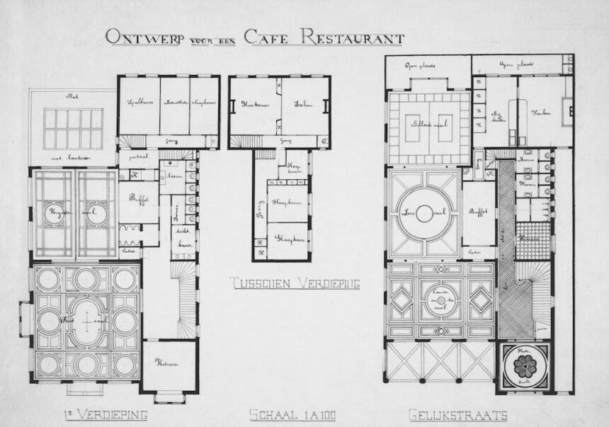
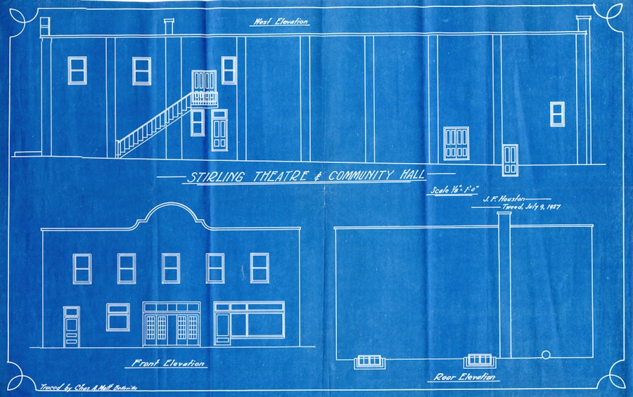
What are hidden room blueprints?
Hidden room blueprints are detailed plans or diagrams that show the layout, dimensions, and features of a hidden room within a building. These blueprints are used by architects, builders, and homeowners to design and construct hidden rooms for various purposes, such as security, privacy, or storage.
What is a lidar map?
A lidar map is a type of high-resolution, 3D topographic map created using light detection and ranging (lidar) technology. This technology uses laser pulses to measure distances and create detailed maps of the Earth’s surface, including buildings, vegetation, and other features. Lidar maps are often used for urban planning, environmental monitoring, and archaeological research.
How are hidden room blueprints different from lidar maps?
Hidden room blueprints focus specifically on the design and construction of hidden rooms within a building, providing detailed information about the room’s layout, dimensions, and features. Lidar maps, on the other hand, are comprehensive 3D maps of the entire building and its surroundings, created using lidar technology to capture detailed topographic and structural information.
What are the uses of hidden room blueprints?
Hidden room blueprints are used by architects, builders, and homeowners to plan and construct hidden rooms for a variety of purposes, including security, privacy, storage, and novelty. These blueprints provide essential information for designing and building hidden rooms that seamlessly integrate with the rest of the building’s structure.
What are the uses of lidar maps?
Lidar maps have a wide range of uses, including urban planning, environmental monitoring, flood risk assessment, forestry management, archaeological research, and infrastructure development. These high-resolution 3D maps provide detailed information about the Earth’s surface and can be used to analyze and visualize various aspects of the built and natural environment.